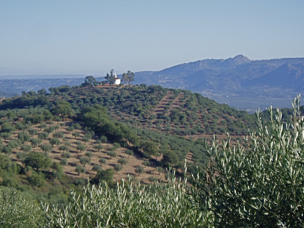
The Hermitage of Alcuéscar, not to be confused with the Visigoth Church
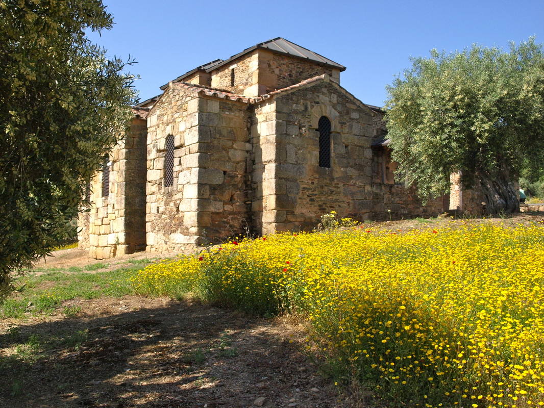
The approach to the Visigoth Church in April when the wild flowers are out
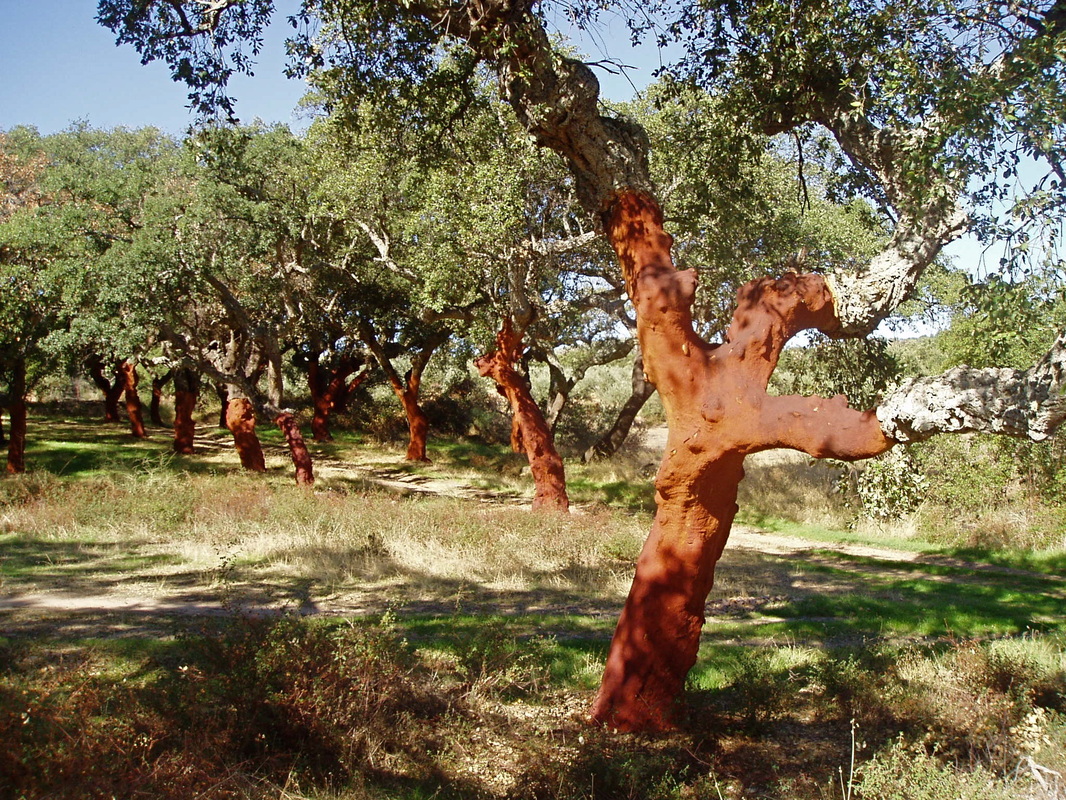
Cork oak trees recently stripped of their bark — the red colour is natural
|
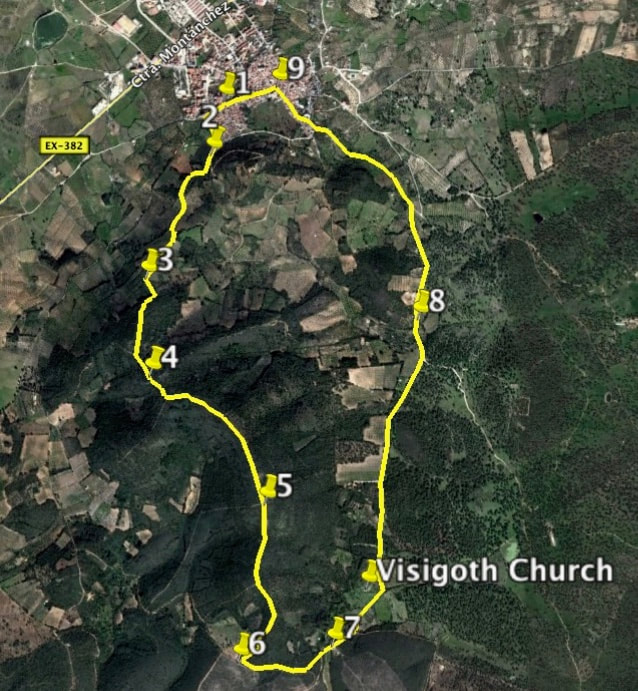
The Walk of the Visigoth Church
Information This route is one of my favourites because I love the Visigoth Church. The walk is rather demanding to start with - a climb of 198 metres and then down again - but the views are great all the way around and the walking is easy after the first part. The Visigoth Church is the oldest example of its kind in Spain and the interpretation centre (shut Mondays) has a film, exhibition, maps and a good guided tour but all of this is only in Spanish. However, an information booklet has been printed in English and it’s sparse but good. The view from the Church is across the valley towards Arroyomolinos. Here, in 1811 during the Peninsular Wars the English, Spanish and Portuguese fought a battle with the French and beat them soundly. Many French soldiers escaped by throwing down their weapons and climbing the face of the Sierra de Montánchez. Alcuéscar, the start and finish of this walk, has both bus and taxi transport. There are bars and shops and a very interesting Plaza Mayor and Church. Start: Alcuéscar Finish: Alcuéscar Time: 3.5 hours plus time at the Visigoth Church Distance: 9.25 kilometres Elevation: lowest 440m, highest 680m Difficulty: medium Route: circular — map by Google Directions From the EX-382 turn left into Alcuéscar at a cross-roads by a café on the left and the rehabilitation centre for accident victims on the right — a huge complex of buildings with an impressive entrance topped by a cross. Go up the road until a ‘No entry’ sign is reached. Turn right and follow the road until just before a T-junction is reached. Park. 1. N 39º 10’ 46.02” W 06º 13’ 55.75” To start the walk go to the T-junction and turn right. Third on the left is Calle Cristobal Colon. Walk past this street to find a footpath going up on the left. Take this path and continue upwards to reach a sharp bend left, into Calle Marcelino Barrero. 2. N39º 10’ 35.28” W 06º 13’ 55.51” Ignore the concreted track ahead. Take the earth track on the right which passes through olive groves and then starts to go up, steeply in places. After approx: 1.40km from the start come to a narrower path that goes left, lined with trees. Take this path and leave the wider track which continues ahead. Enter an area of pine, oak and a few chestnut trees. 3. N 39º 10’ 11.07” W 06º 14’ 14.18” Climb higher and get a great view of the whitewashed Hermitage of Alcuéscar with Montánchez Castle in the distance. Continue going up through the woods to arrive at the highest point of the walk (698m). The views all around are fantastic. 4. N 39º 09’ 51.6” W 06º 14’ 12.3” After the climb, comes the descent. The path, lined with lavender, broom, cistus and Spanish Heath, is in good condition but there are loose stones in places that slide underfoot. Go slowly. Ignore any junctions left or right. 5. N 39º 09’ 28.1” W 06º 13’ 45.3” The descent becomes extremely steep but the views are well worth the effort. The track levels off for a while but then descends once more to meet a T junction. Turn left. 6. N 39º 08’ 56.99” W 06º 13’ 53.09” Walk on through the trees to come to a clearing with the road ahead as the direction. However, to the left is a small track that goes past orange groves to a natural spring. If you need extra water fill up your bottles. 7. N 39º 08’ 59.2” W 06º 13’ 29.9” Walk on the main road ahead and drop down to see the Visigoth Church in the distance. Arrive and take a break — visit the interpretation centre to see the film and exhibition and then go and see the Church. An ancient mill lies to the north. The view over the valley towards Arroyomolinos, and even Montánchez, in the distance is quite something. There’s also some toilets! Real luxury on walks! After the stop continue along the road. Pass through an area of cork oaks. The oaks are stripped of their bark every nine years. This part of the route is entirely on the road. It is, however, very quiet and runs through the cork oaks, olive groves and farming fincas. 8. N 39º 10' 03.24" W06º 13' 06.90" The road comes to the outskirts of Alcuéscar. Keep walking and pass the Fuente del Castaño on the left. Keep ahead to arrive in the small square. 9. N 39º 10’ 48.63” W 06º 13’ 42.10” Turn left to walk down the main road, Calle Real. Reach the top of the street on the right where the car is parked. A thoroughly lovely walk, especially in Spring. Photos: March and April This walk can be combined with the following walk, 'Charca Valderrey' making a route of 19.45 km. |