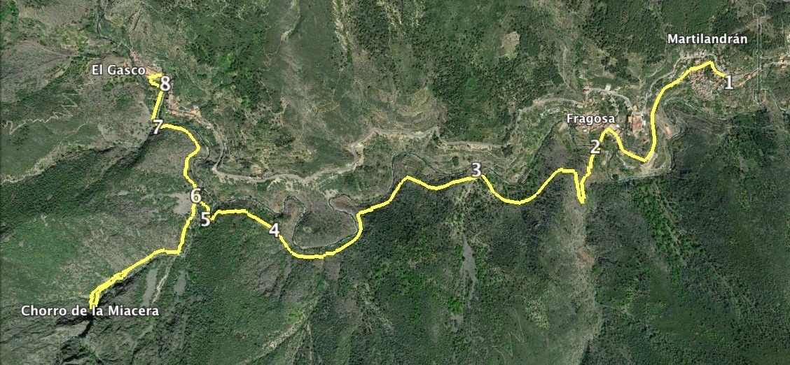
Over millennia, the River Malvellido has carved out a twisting path in the mountain landscape
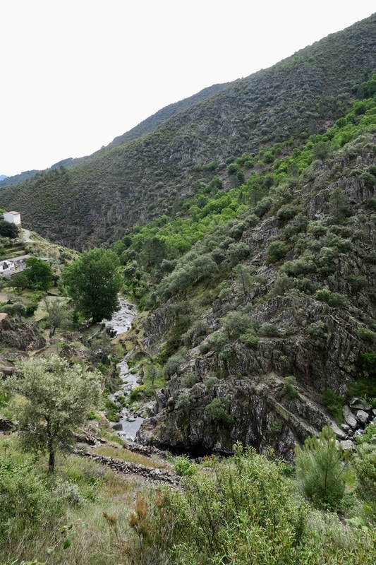
The Chorro de la Miacera, a spectacular sight after the autumn or spring rains
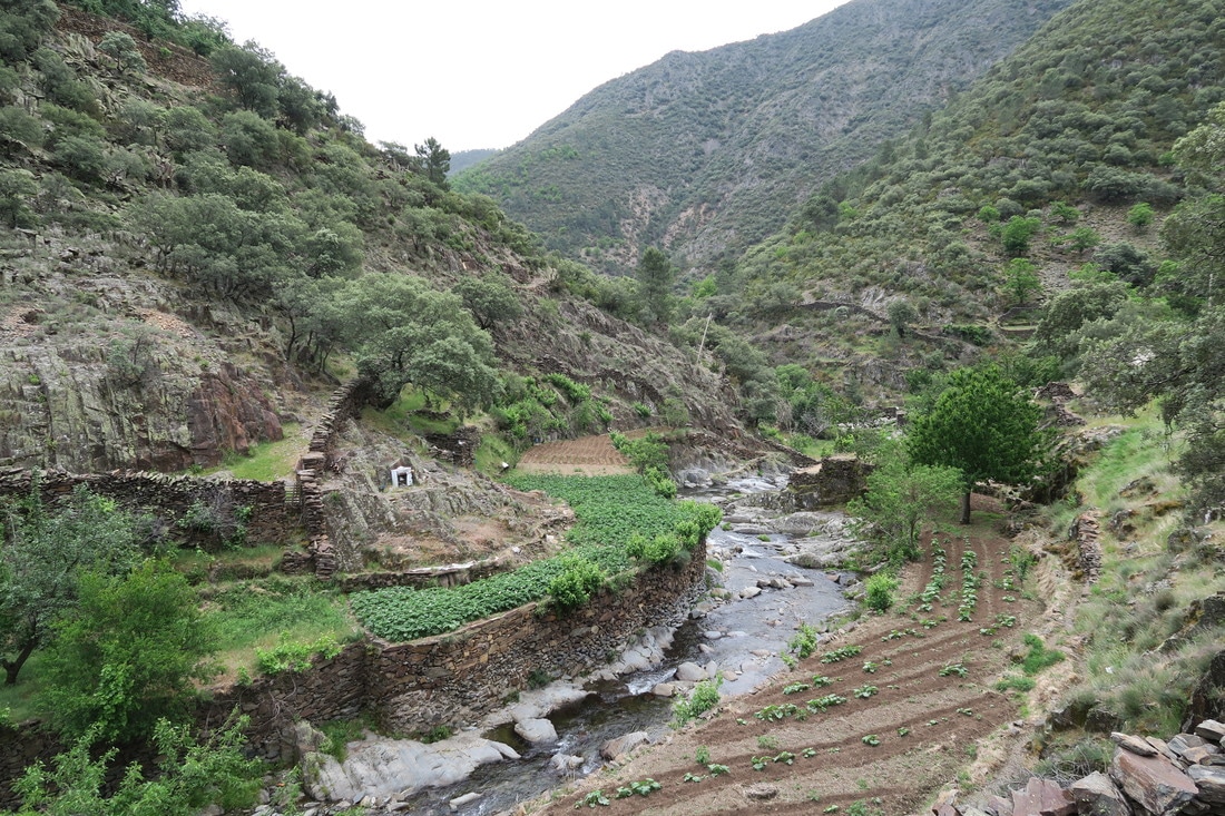
Small, but productive, vegetable gardens on the banks of the river
|
El Chorro de la Miacera
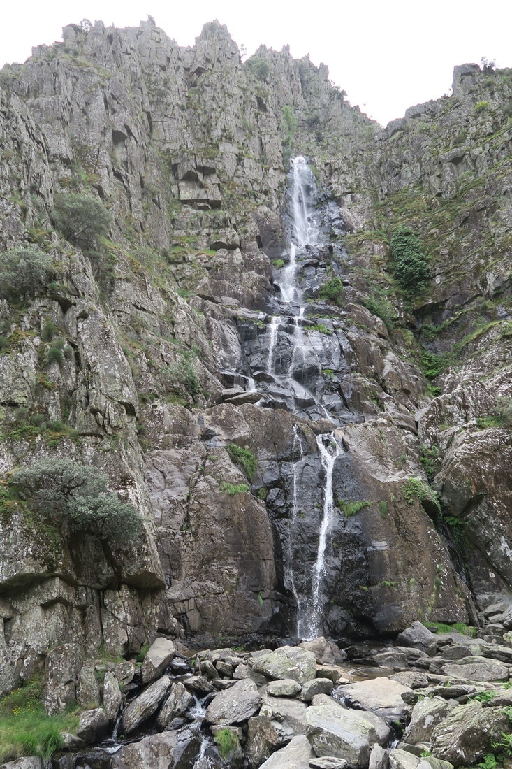
Information This is only a short and fairly easy walk but if done out-and-back and includes the diversion to see the waterfall it is a respectable 9.40km. This route runs on soft earth footpaths occasionally lined with slate. The path follows the side of the sierra and reflects the meandering river that is never out of sight in the valley below. The views are dramatic and the rugged sierra is covered with trees and bushes. There are cherry orchards and chestnut trees along the way but, near the villages there are vegetable gardens on the terraces near the river. The diversion to see the waterfall is well worth the effort, especially after the winter rains. The village of El Gasco has an old part that is almost untouched since the middle of the last century. There is an Interpretation Centre which shows a typical Las Hurdes house as it was 100 years ago. Start: Martilandrán Finish: El Gasco or return to Martilandrán Time: 2.5 - 3 hours Distance: 8.00 kilometres in total ( plus the diversion of 1.40km) Elevation: lowest 625m, highest 900m Difficulty: medium Route: out and back — map by Google Directions On arrival in Martilandrán on the EX-368 do not go too far into the village. Park near a definite Y-junction where the left turn drops down into the village. The 'main' road continues on to La Fragosa and then El Gasco. Start by the Y-junction and take the left turn. 1. N40 23' 56.30" W06 17' 37.38" Follow the road as it drops down, bends left and continues going slightly left as it continues downward and then loops left then right. Enter La Fragosa. After 840m the road seems to stop in a small square where cars are parked. Walk to the 'end' of the square and turn left into a tiny passageway between two houses. Follow this small path as it drops down to a bridge over the River Malvellido. 2. N40 23' 47.27" W06 17' 59.22" Once over the bridge the path becomes rougher and climbs up steeply and makes a few zig-zags. Look around for views. The path continues to loop around to go back in the direction we have just walked. More loops follow and the views change as the villages of Martilandrán and La Fragosa disappear. The path is clear with occasional helpful signposts. Pass a distinctive bridge across the river below. 3. N40 23' 44.52" W06 18' 20.39" Continue on looking at the views all the time. Reach an area of cherry orchards, especially on the right. The rule is that cherries on branches overhanging the path can be eaten. Do not enter the orchard itself as that constitutes stealing. 4. N40 23' 36.03" W06 18" 51.83" Within 300m come to a wide, open area. Cross over several low waterfalls in this pretty spot for flowers, butterflies and birds. 5. N40 23' 37.26" W06 19' 02.81" Reach a well signposted junction where the path on the left goes up to view the waterfall, Chorro de la Miacera. 6. N40 23' 40.07" W06 19' 04.57" The path is clear and climbs up with the river on the left which makes pretty falls of water over the giant granite boulders in the river bed. Come to a newly-constructed (May 2017) walkway over a tricky boulder-strewn section. Continue on up. It's quite steep but the view at the top is worthwhile. Explore. Relax. Then retrace steps back to the junction. Turn left and continue to reach a café-bar situated at the side of the river and before El Gasco is reached. 7. N40 23' 48.40" W06 19' 10.39" Continue on the path, now concreted, to turn right into the village, turn right again to come to an open area where there is a car park, a viewing point, information boards and the way to reach the old part of the village. Further down the road is Bar Bodegón. We ate lunch there and the food was excellent, the service cheerful and it was all very nice. They also gave out free maps! 8. N40 23' 53.68" W06 19' 09.12" Do buy some of the local produce, especially the honey. If you don't want lunch or huge amounts of food have a drink and tapas or just coffee. Villages in Las Hurdes do need tourists, and that includes walkers, to spend a little to help the local economy. |