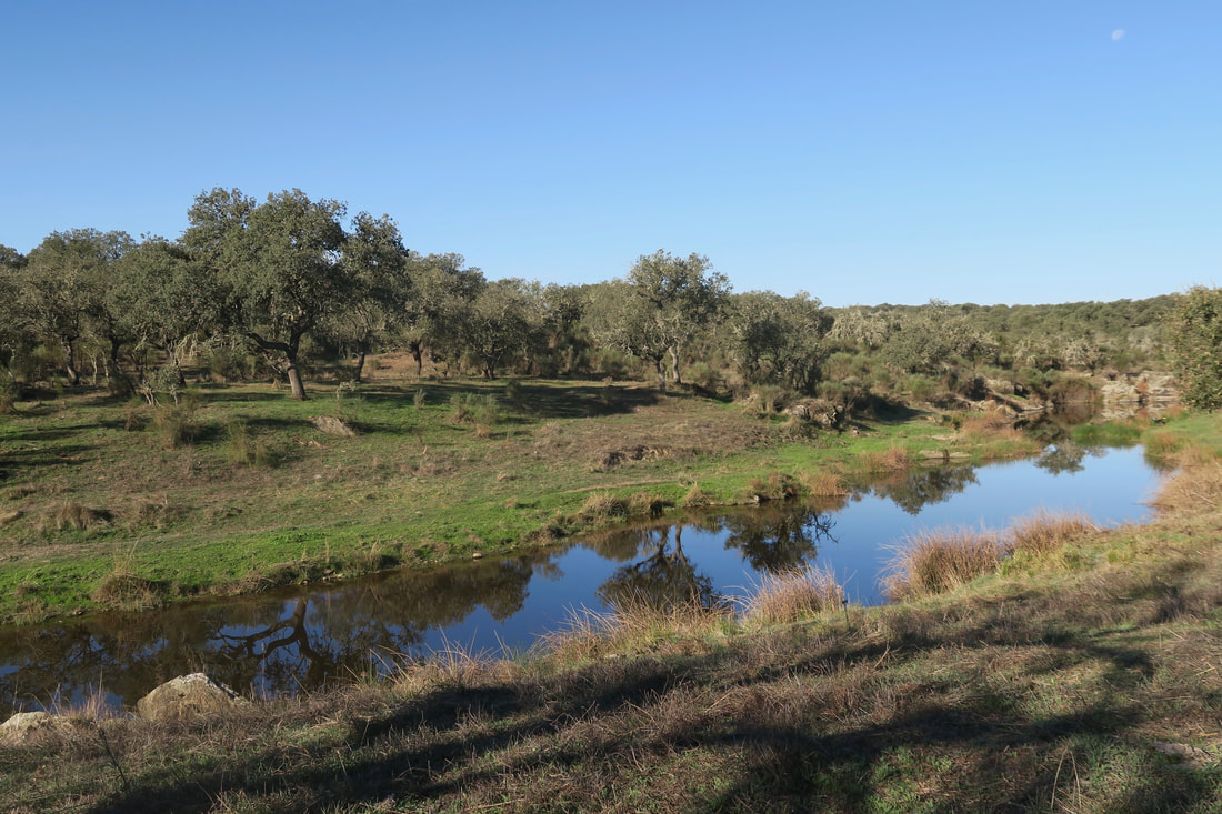
The river after the crossing in Villasviejas de Tamuja
Approaching the mill from the side of the dam
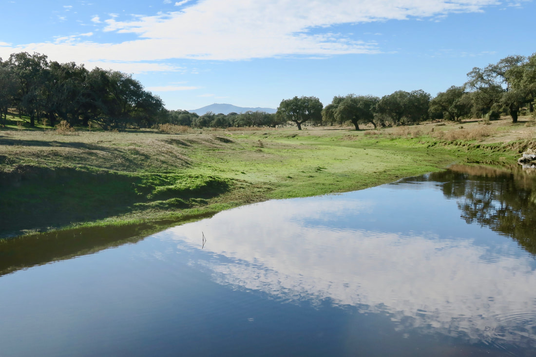
Peaceful meadows
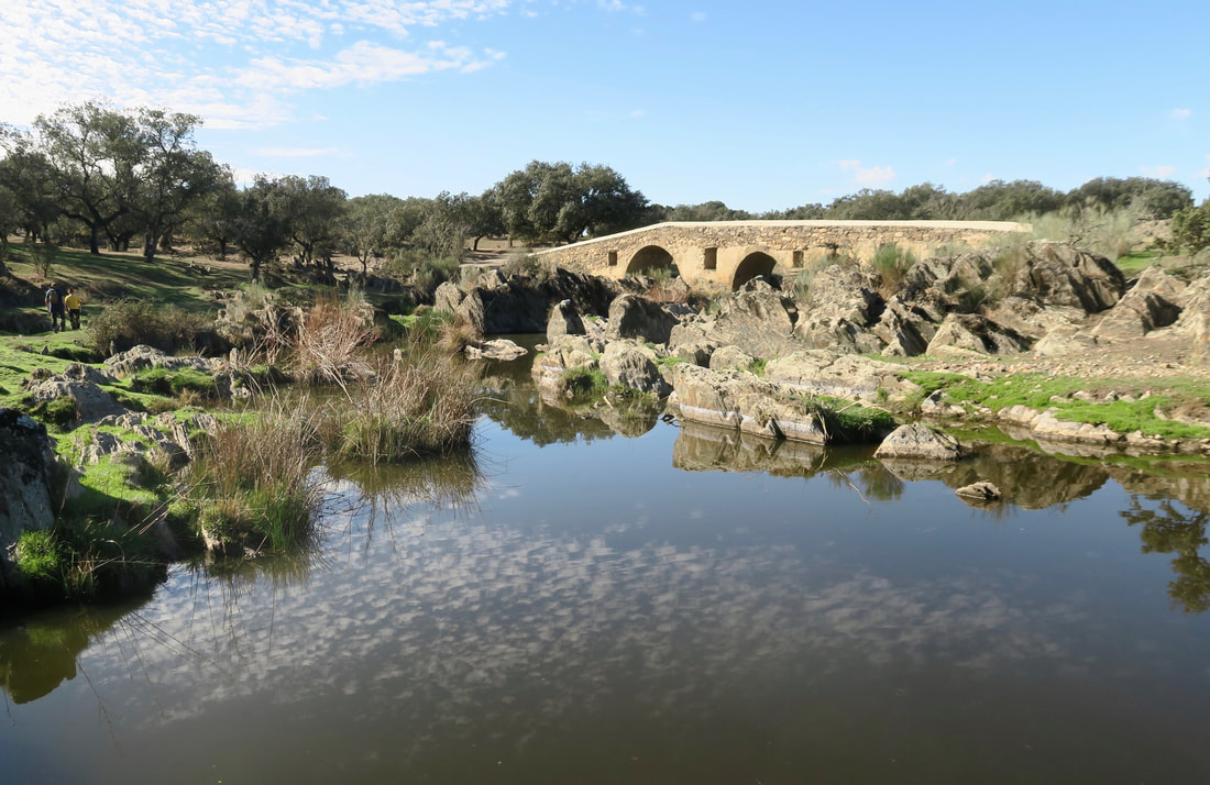
The impressive bridge seems to be in the middle of nowhere in particular
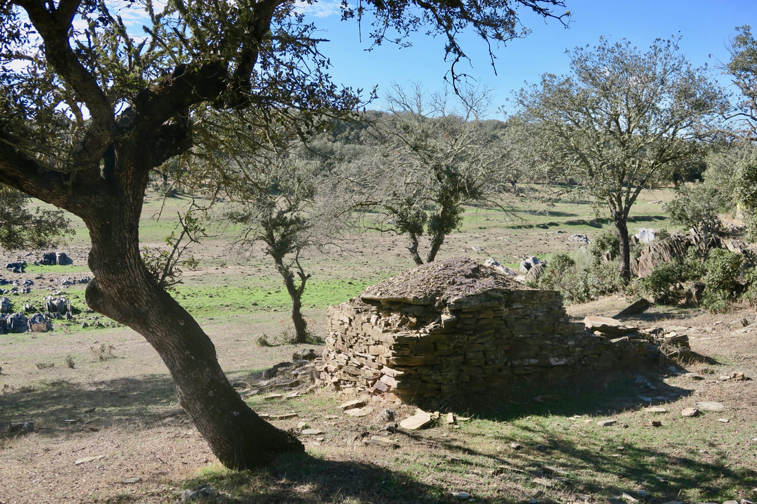
One of the many pig-pen-chozos where the pigs, which ate the acorns in the dehesa, could shelter
|
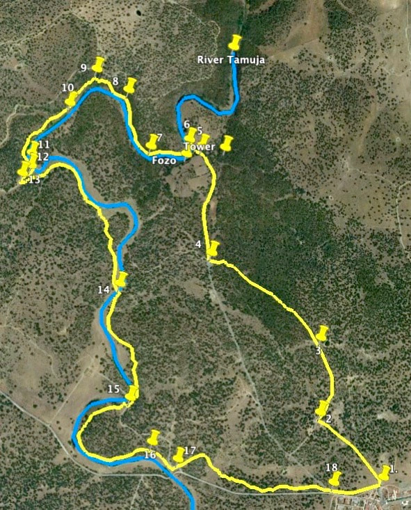
Along the Tamuja River Information The walk goes through classic dehesa landscape to the Celtic village of Villaviejas de Tamuja (see previous walk). It then follows the meandering Tamuja river to an old, carefully restored mill. The second half of the walk is along the river walking through peaceful meadows scattered with oak trees. There is an interesting bridge and some ancient pig chozos before the return to the starting point. The walk is not suitable for very hot days because there is not much shade in long stretches. Sheep and cattle may be grazing so keep dogs well under control. The walk can be combined with the previous one to make a distance of 19.40km. However, the walk is not possible in times of huge rainfall as the stepping stones at GPS 6 will be covered with fast-flowing water. Botija is signposted from the EX-206 Cáceres-Miajadas road. The turning is at the village of Torremocha — on the left coming from Cáceres and on the right coming from Miajadas. Start: Botija by the Cheese Factory Finish: Botija by the Cheese Factory Time: 2.5 hours plus stops Distance: 8.40 kilometres Elevation: lowest 375m, highest 452m Difficulty: low Route: circular — map by Google Directions The road into Botija from the EX206 will bring you to the cheese factory on the northern edge of the village. Park in the quiet roads near the factory. 1. N39°20'52.03" W06° 04'32.25" Cross the cattlegrid and walk down the wide track that leads into the dehesa so typical of Extremadura. Arrive at some farm buildings on the left and follow the track as it bends to the right. 2. N39°21’03.90" W06° 04'46.92" Pass a charca on the right. It is worth watching for a while to see birds. 3. N39°21'17.38" W06° 04'46.53" Keep on the track as it passes through an area of cistus bushes with their sweet fragrance all around and in flower in late spring. Reach a gate and cattlegrid on the right. This is the entrance to the Villasviejas protected area. Walk through (and over) and keep on the track. 4. N39°21'33.00" W06° 05'11.63" Although there are several interesting areas with ruins, refer to the previous walk for more details. On the left there are foundations and a fozo while to the right, over another track and behind a wall, are the remains of a watch tower and steps going down to a stream which feeds into the Tamuja and from which people used to collect water. 5. N39°21'52.26" W06° 05'13.44" Follow the track down to the river and cross over on the stepping stones. 6. N39°21'53.46" W06° 05'16.38" On the other side of the river, pick up the footpath that bends left and goes up a small rise. The river is on the left. 7. N39°21'52.37" W06° 05'25.39" Follow the footpath that bends left as it follows the river. There are low trees and bushes and small ups and downs but nothing strenuous. 8. N39°22’02.58" W06° 05'30.34" Turn sharp left at a vague junction of paths. Follow the river. 9. N39°22’06.42" W06° 05'37.68" Keep the river on the left and pass distinctive areas of spent rock. 2,500 years ago this was the area where the people of Villasvieja worked iron. They built huge furnaces, cut down trees for fuel and heated rocks to split them and extract the iron. Many rocks and small stones in the area are black and still contain iron. Villasvieja iron was of good quality and sought after by traders from far and wide. 10. N39°22'0.42" W06° 05'44.10" Cross the river by climbing up and over the impressive slate slope. The mill is on the right. Turn right and carefully walk on the top of the dam to the mill. Or step down on to the ground beyond the dam and wall to the mill. 11. N39°21'51.48" W06° 05'53.12" The mill can be entered and it has been restored to show how it used to work. The area outside is a good picnic place and there are basic toilets in the last building up the slope on the right looking away from the mill. 12. N39°21'48.55" W06° 05'50.96" Walk away from the mill and go through the gate, closing it afterwards.Turn left and walk around the wall to pick up the wide track. The mill is on the left and so is the river as we follow the bends through open pastures. 13. N39°21'47.88" W06° 05'55.44" Follow the track or pick up a footpath to cut off a bend in the river. Cross the river on the stepping stones to put it on the right. 14. N39°21'27.72" W06° 05'33.12" Reach a bridge. The walk does not cross it but continues to the left of the bridge. However, it is worth exploring. 15. N39°21’07.16" W06° 05'31.20" Continue through the dehesa. Ancient pig-pen-chozos are dotted around the countryside. Villagers used to run pigs in the dehesa where they fed on the acorns and snuggled up in the pens at night.. 16. N39°20'59.10" W06° 05'26.22" The track comes to a side road. Cross over. Leave the river on the right and walk through the dehesa keeping the road on the right. 17. N39°20'55.92" W06° 05'20.29" The track joins the road. Walk on the road back to the cheese factory. 18. N39°20'51.24" W06° 04'44.04" Cheeses can be bought from the factory shop at their prices rather than supermarket prices. The cheeses are many, various and delicious. Photos: October |